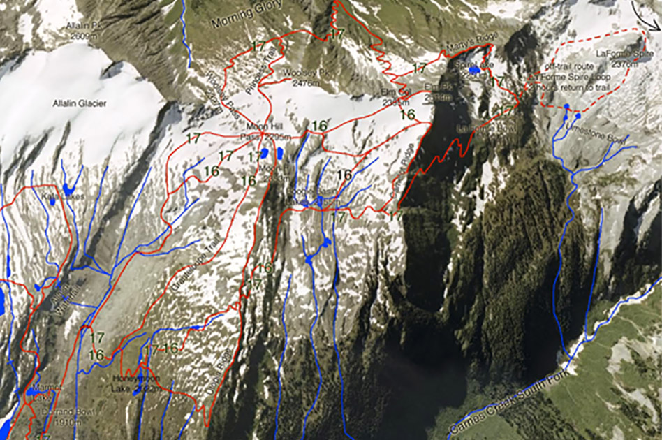
Elm Peak Trail
- Level of hiking: Difficult
- Time: 6 to 7 hours
- Lowest elevation: 1910 m, Durrand Bowl
- Top elevation: 2514 m, Elm Peak
- Total elevation gain: 750 m
- Total distance: 8 / 9.5 km
Route:
From the Durrand Glacier Chalet walk in the Direction south, past the private hut. There take the trail leading west, and follow the trail diagonally down a long side-slope which is at first forested. Follow this trail to the Durrand Creek Bridge. Cross the bridge and follow the main trail leading to your right (west). After a few hundred meters you come to a second branch-off, again continue on the main trail leading to your right (west). This will bring you to Honeymoon Lake.
At the south end of the lake take the trail leading towards south (left), winding its way up to the upper Utopia Ridge. Once you are on the ridge (at the top of the shale switch backs) branch off to the left and after a few more meters of up-hill branch off to the right and walk down-hill (west/ southwest) into the Boogie Basin along the west slopes of Moonhill.
Now walk diagonally towards south up the Boogie Basin, to the narrow and prominent V-notch of the Elm Col. From the Elm Col walk up the steep East Ridge of Elm Peak to its summit. To descend walk back down the East Ridge to the Elm Col. From there you have two options.
A) Shorter option. Walk diagonally across the Boogie Basin to the Moon Hill Pass and there take the marked trail down the Durrand Bowl.
B) Longer option, but more interesting. From the Elm Col walk down the trail leading south, into the upper Woolsey Bowl. At the first branchoff take the trail leading east (left). Now follow this trail to Woolsey Pass and from there follow the marked trail down the Durrand Bowl.