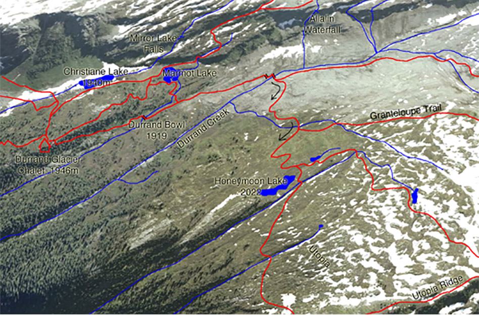
Honeymoon Lake trail
- Level of hiking: Easy
- Lowest elevation: 1910 m, Durrand Bowl
- Top elevation: 2022 m, Honeymoon Lake
- Total elevation gain: 148 m
- Total distance: 4 km
Route:
From the Durrand Glacier Chalet walk in the direction south, past the private hut.
There take the trail leading west, and follow the trail diagonally down a long side-slope which is at first forested. Follow this trail to the Durrand Creek Bridge. Cross the bridge and follow the main trail leading to your right (west). After a few hundred meters you come to a second branch-off, again continue on the main trail leading to your right (west) and crossing a small stream. Another 300 metres and you will arrive at the charming Honeymoon Lake.